

A few days ago, I made this batch of biscuits. They’re a variation on a recipe by Justin Gellatly for “the perfect dunking biscuit” found in his book Bread, Cake, Doughnut, Pudding, but I fancied adding cocoa. Cos, well, chocolate. They’ve got a great snap, and dunk well, but I took them on a walk with my friend Alex. We ate them on the site of Balsdean, a village or hamlet*, that is now lost, or at least gone.
If you’re a bit of a map geek, like me, every time you visit somewhere new, you need a map, preferably (in the UK) a 1:25,000 OS map, plus its digital download counterpart these days. On holiday in Dorset earlier this year, I loved poring over the map and seeing the italic font used by OS for post-Roman archaeological sites, saying “Medieval village (site of)” , “Church (rems of)”. The English landscape is littered with these. It’s fascinating to muse about, then investigate, what actually happened to these places. Why do some villages survive, grow and swell into towns or cities, whereas other fail or fade away?
The reasons are many: a wave of the plague may have depopulated a place to the point where it simply couldn’t continue to exist, without residents to work the land. Something similar happened near here to Hamsey, where the original site of the village now consists of just a church and a barn. Or it may have been lost to changing landscape, crumbling sea cliffs for example, such as Dunwich on England’s East Anglian coast. Another factor may be changing technology. An interesting example of a village dying due to technological change close to (my) home is Tide Mills.
Tide Mills, on the Sussex coast between Newhaven and Seaford, came into being fairly late on, when the landowner decided to use the tidal range to grind grain. A tide mill was built and used between 1788 and 1883, grinding wheat for flour (just to get this post back to my blog’s main theme for a second), in combination with a wind mill. When steam power arrived, the tide mill became obsolete. Despite being clean and green! Not really concerns in the 19th century, other than among Romantic poets. The main concern was it was hard to maintain, so more expensive than a coal-fired steam mill.
The village’s railway station was closed in 1942, three years after the final residents had been removed. During the Second World War, the site was used for street fighting training. Today, you can still see the remains of many buildings. Which is a lot more than can be said for Balsdean, which was cleared of its remaining populace then used for artillery and tank training in the war. There are some amazing before and after photos on this site. The manor looks very fine. People would pay a pretty penny for a place like that in these parts these days.

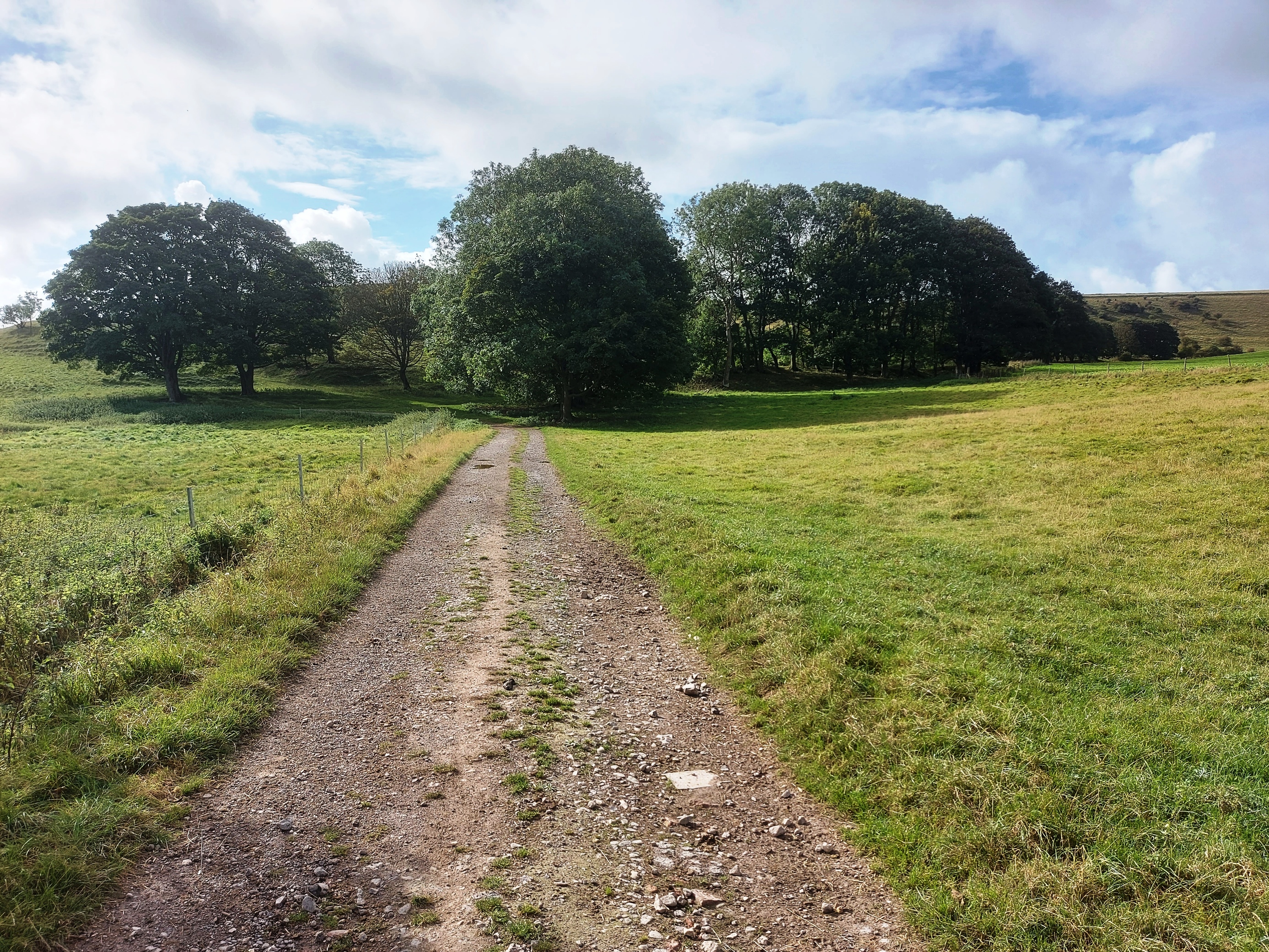
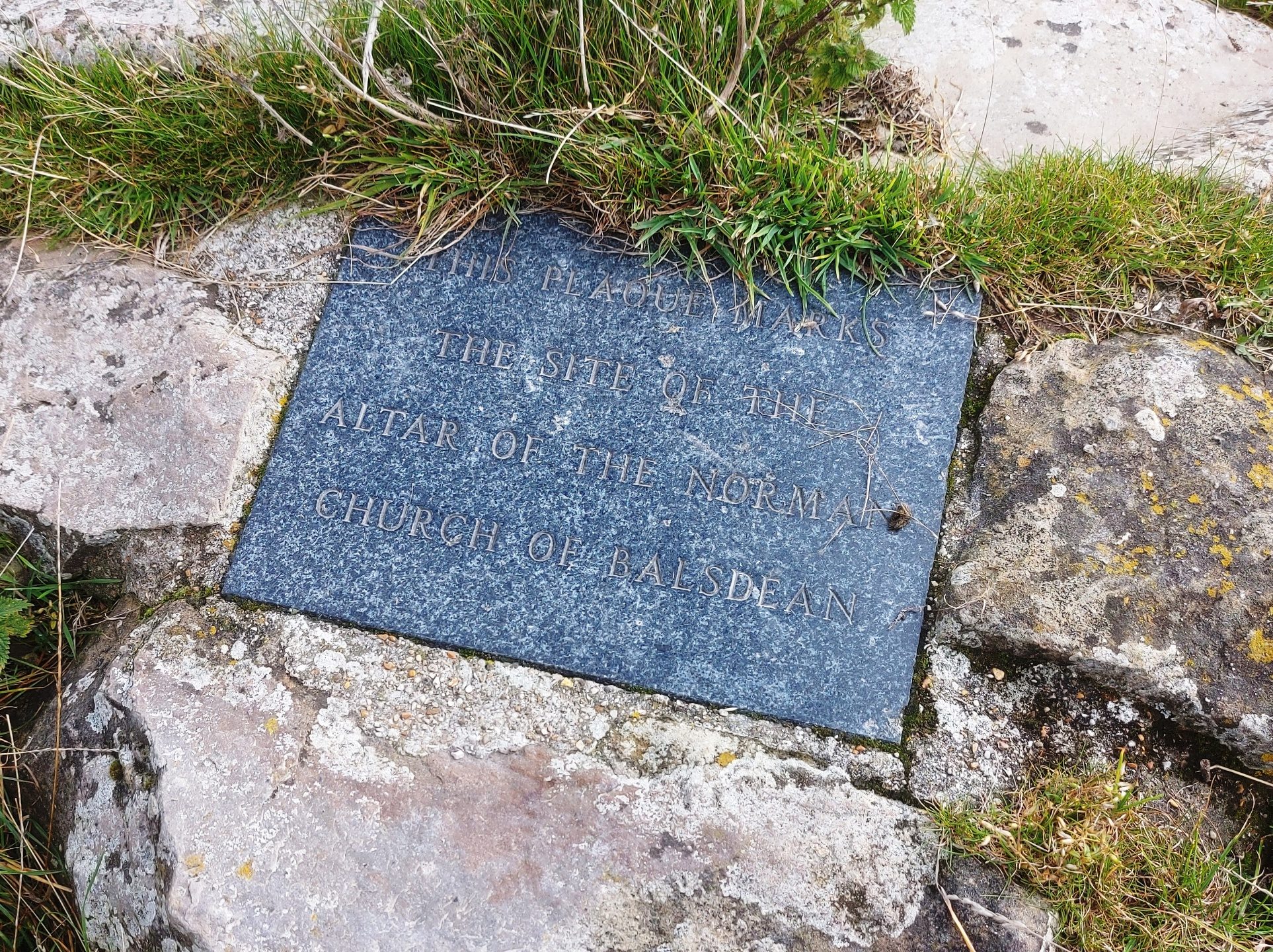
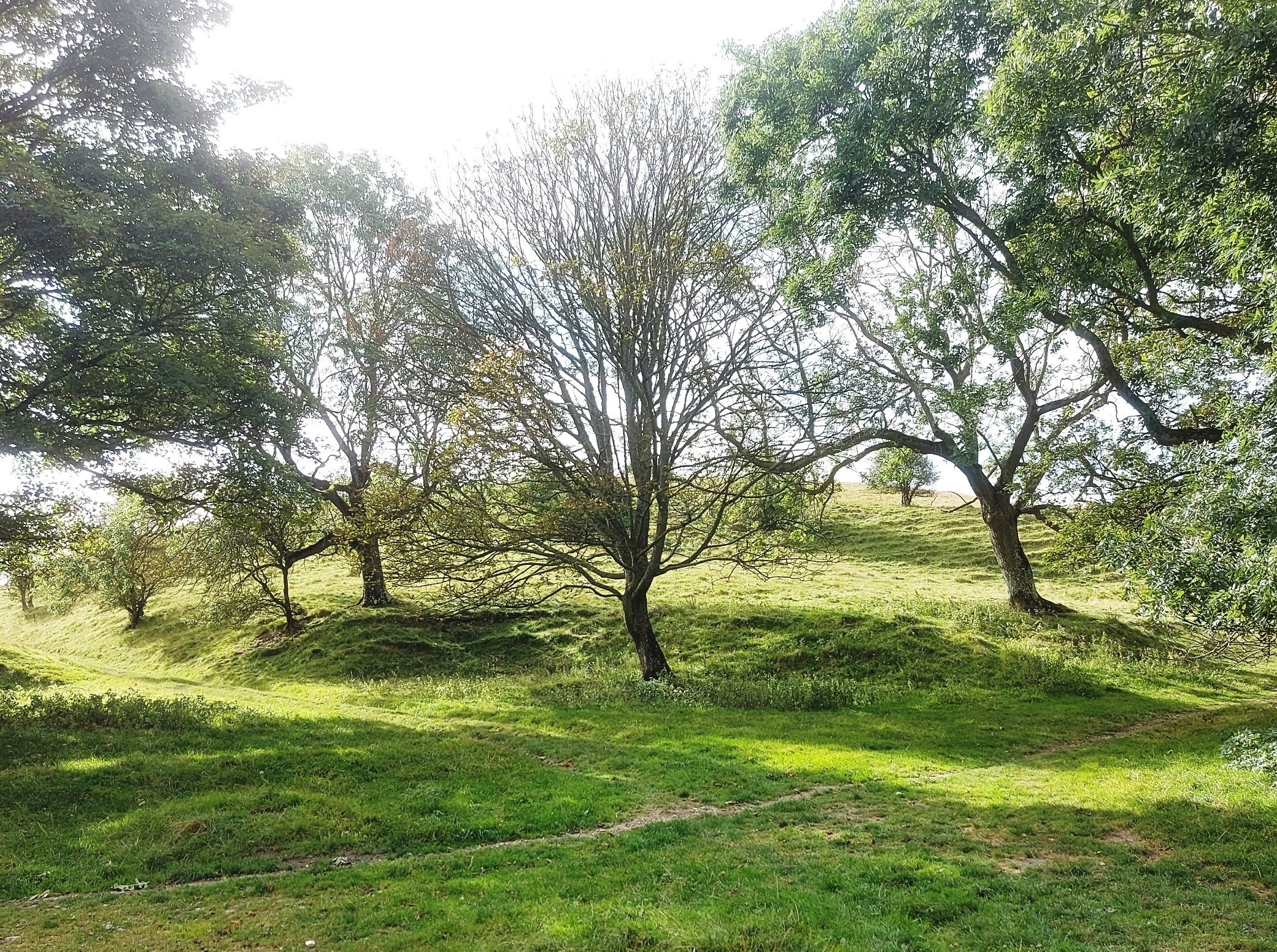
It’s a very peaceful spot now. Despite something of a howling wind on the Downs’ exposed flanks during our walk, among the trees at Balsdean we had a quiet moment to enjoy the biscuits and try to picture the village and its church. To the modern, historical conservation-oriented mind, the intentional shelling of a Norman church** is boggling but the world was a very different place in 1942. The Battle of Britain in 1940 may have forced the Nazis to postpone Operation Sea Lion, their invasion plans, but Britain was still besieged. Today, all that remains of the church is a pile of stonework and a small plaque marking the location of the altar.
It’s a place that’s clearly inspired people, including the Brighton band Grasscut, who created a musical extra-urban pyschogeographical journey around the area with tracks on their 2012 album 1 inch: 1/2 mile. They even hid “in the environs of Balsdean, a single, utterly unique Grasscut artefact”. Clues to its location can be found in this track, A Lost Village. Which sounds intriguing, much like Kit Williams’ famed book/treasure hunt Masquerade from my childhood.
If you’re interested in visiting Balsdean, for the walk, for the history, or to look for Grasscut’s artefact (assuming no one’s found it), strangely it isn’t marked with “Medievel village (site of)” on the OS map, but here’s the What Three Words spot where the various lanes met in the centre of the village is, with an OS grid reference of 378058, while this is the site of the church. Switch to satellite view and you’ll see more lumps and bumps and evidences. If you like funny English place names, Balsdean is where Balsdean Bottom meets Standean Bottom, just south of Castle Hill Nature Reserve, not far from the South Downs Way southwest of Lewes.
As for the biscuits, they helped us on our way, and I’m going to keep tweaking the recipe. I’ll post it here when I’m satisfied.
* A hamlet is a small village, which etymologically quite likely comes from ham, meaning home or place of residence, and let, a French diminutive. One dictionary definition says it’s a village without its own church. So technically Balsdean wasn’t a hamlet, as it had a Norman church.
** This informative site gives some more detail about Balsdean from a 1990 source. The church, or chapel, had fallen out of use as a place of worship by the late 18th century, becoming instead a farm building. So it wasn’t quite so shocking to shell it into a pile of rubble.

Fascinating
Thanks you. I’m fascninated how the landscape is affected by humanity, and how it changes. Especially when nature has a change to recover a bit!
Just so much to follow up on here. The biscuits look great, but the history and photos are the main interest for me. Looks like a big subject to research…….